ICCS training on biodiversity monitoring methods
The Interdisciplinary Centre For Conservation Science (ICCS) is a research group based in the Department of Biology, University of Oxford. Through research and collaboration across the world, the ICCS and its fellows work at the interface of social and ecological systems, using a range of social and ecological methods to address key issues in current conservation, including the interface between conservation, equity and human rights.
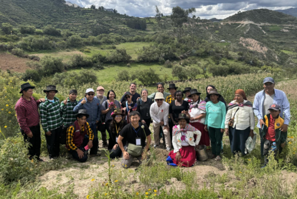
The primary focus for ICCS on the Transformative Pathways Project is to provide on-the-ground support and training to Indigenous Peoples and local communities in planning, implementing and monitoring strategies for conservation and sustainable use on their lands. Working directly with local and national partners, ICCS co-develop and pilot a suite of biodiversity monitoring methodologies and approaches for local use and give support in applying them to enhance customary systems of conservation and resource management. On October 17th 2023, Stephanie Brittain from ICCS and Tom Rowley from Forest Peoples Programme (FPP) paid a visit to the Ogiek of Mt. Elgon – Kenya, to facilitate community-led biodiversity monitoring training.
Type: Article
Region: Africa
Country: Kenya
Theme: Biodiversity Monitoring, Sustainable livelihoods, Community-led conservation
Partner: Chepkitale Indigenous People Development Project (CIPDP)
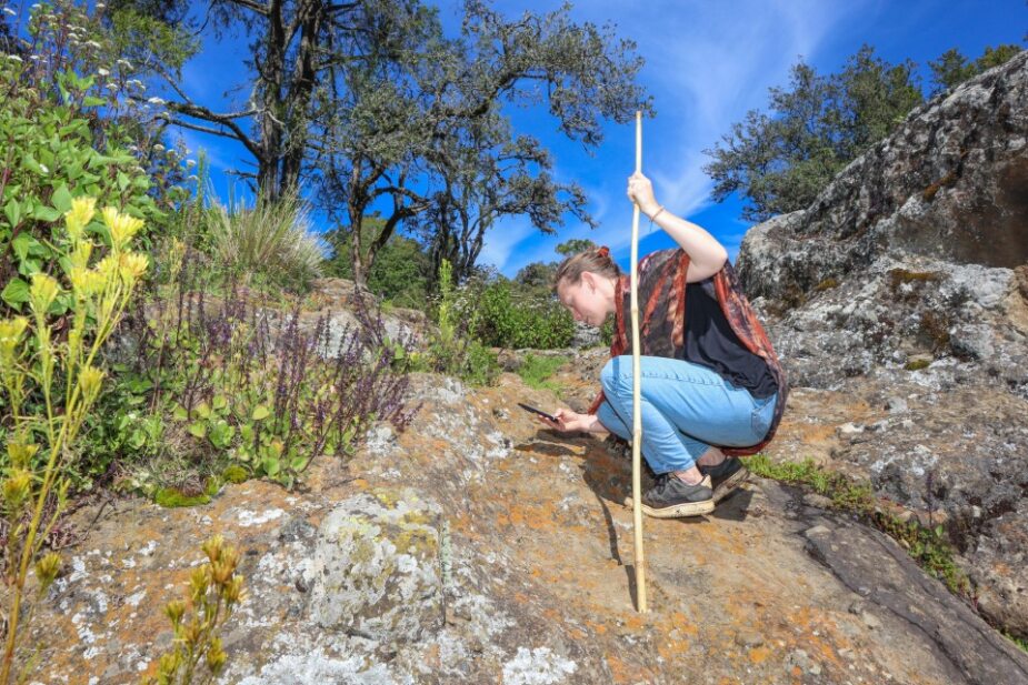
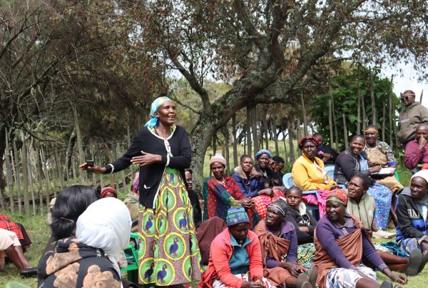
Stephanie exploring biodiversity of Mt.Elgon
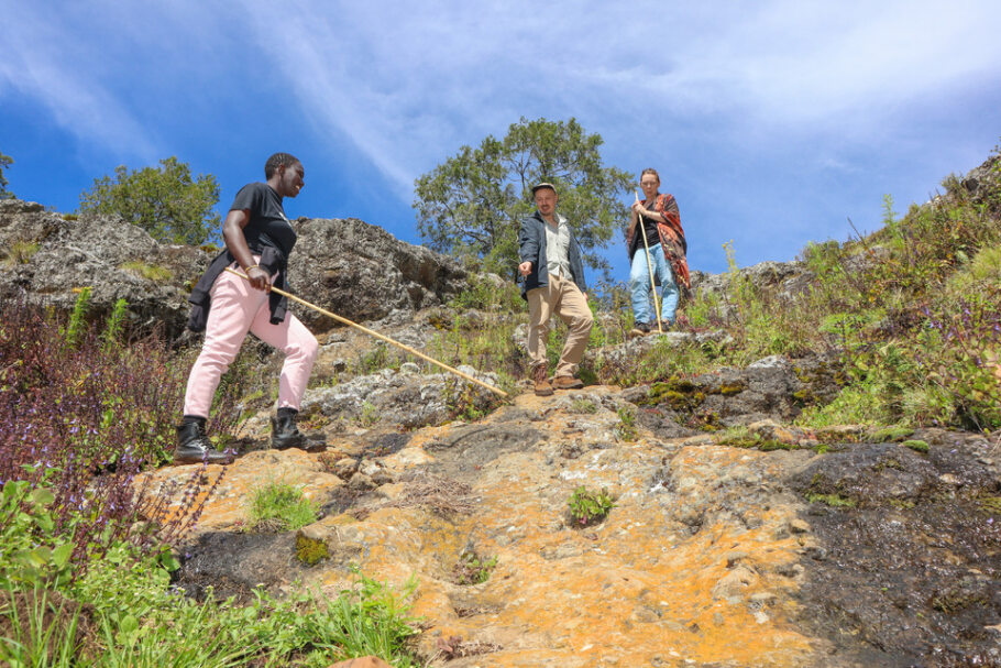
From left: Phoebe CIPDP, Tom FPP and Stephanie ICCS explore Mt.Elgon Forest
Why monitor biodiversity?
The Ogiek people have long safeguarded Mt. Elgon’s rich biodiversity, and were until recently still subject to forceful evictions from their lands in the name of conservation. Having won a landmark ruling in 2022, stating that previous evictions from their land were unlawful, the Ogiek want people to recognise that their traditional practices and ways of managing the land benefits the rich diversity of their ancestral lands on Mount Elgon.
To achieve this, the Ogiek want to complement their rich local indigenous knowledge and ongoing monitoring practices with scientific methods to demonstrate the rich biodiversity on their land to a wide audience, including conservation practitioners and policy makers. The biodiversity monitoring data will also be used by the community to guide their continued sustainable use of natural resources, in line with their Bylaws.. For this reason, training on monitoring methods was crucial.
Although satellite maps can inform on forest loss over time, it doesn’t demonstrate how biodiversity within those forests are faring, hence the need for biodiversity monitoring.
What needs to be monitored and why?
Two biodiversity fellows from the community had a 3-month fellowship programme (from April to July 2023) to develop community-based biodiversity monitoring at Oxford University, as part of the IKI Transformative Pathways project, and also lead knowledge exchange workshops where they shared their rich knowledge of Mount Elgon and the challenges of conservation with academics and practitioners from across the UK. Prior to visiting Oxford, they led an initial community meeting where priority target species for monitoring were identified. The key animal and plant species include:
- Bamboo (e.g. the distribution and sustainability of harvest practices).
- African olive (e.g. the illegal burning of charcoal and logging)
- Elgon teak (e.g. illegal logging)
- Medicinal plants
- Bushbuck and dik-dik (e.g. distribution and threats to the species from neighbouring communities)
- Elephants (e.g. distribution and co-existence)
- Hyena (e.g. documenting livestock predation to develop possible solutions).
They also identified indicators of a healthy territory, such as clean air, water, land that safeguards their humanity, elders’ respect for the youth, abundant trees and beehives, and availability of herbal medicine, which can be used to develop a holistic sense of what parts of their territory are healthy or not based on indigenous knowledge.
Training
Tom and Stephanie arrived in Kenya on October 17th 2023 with the goal of enhancing the capabilities of CIPDP’s staff and the local community in monitoring techniques that compliment their existing indigenous knowledge and informal monitoring efforts. Over three days, they conducted training for five staff members involved in the Transformative Pathways project. This was followed by a community meeting at Laboot. The training of the staff was imperative to enable them to train and guide community monitors.
At the community, the aim was to introduce monitoring work as a follow-on from their ongoing successful mapping work, and seek consent for this next phase.
Speaking at the meeting, Stephanie stated “Monitoring will not replace indigenous knowledge with science, but rather combine both to make a strong argument for environmental stewardship.” The community gave their consent, one of them stating “Lets monitor our biodiversity for intergenerational transfer of knowledge.”
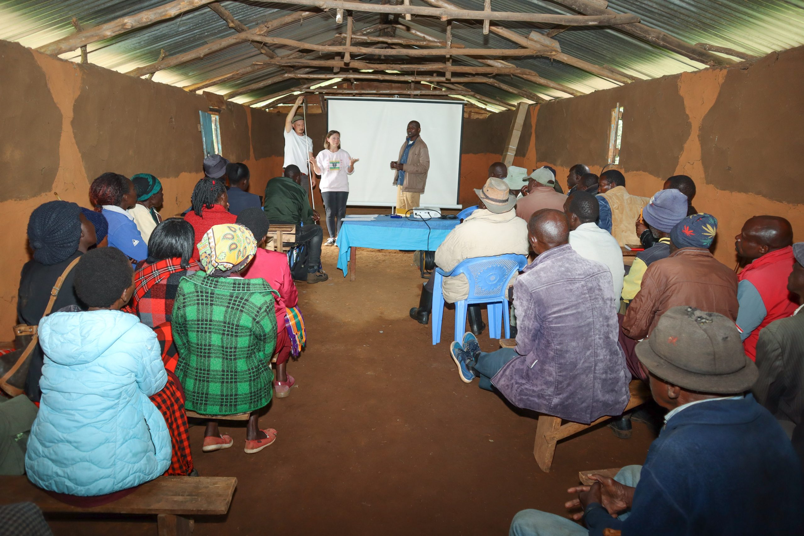
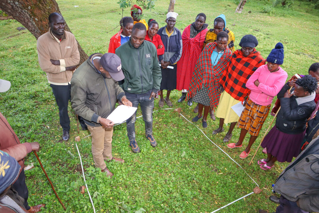
Workshop on monitoring methods.
Training on line transect.
Four monitoring methods will be used to compliment the existing Indigenous practices of verbal reports to Elders and forest walks and high-point surveys:
- Quadrats – A systematic ecological sampling method involving the use of square or rectangular frames (quadrats) of defined sizes to collect data on the distribution and abundance of plants, animals or other organisms in a specific area. Monitors will place them randomly or systematically, focussing particularly on the bamboo forest belt and record the type and quantity of organisms within them, evidence of harvest, and human use, and repeat the process across multiple quadrats over time to gather representative data for analysis.
- Line transect – A data collection technique involving establishing a predetermined line (transect) within the territory, along which monitors walk to record the presence and often the location of plants, animals or human activities. By systematically surveying along the transect line and recording relevant data, such as tracks, nests, or direct sightings,
researchers can assess the distribution and abundance of mobile and elusive organisms. This can be helpful for monitoring the presence of elephants and other mammals, or evidence of illegal logging, hunting or charcoal burning. - Camera traps – A non-invasive data collection technique using motion-activated cameras to capture images or videos of wildlife and organisms in their natural habitat, providing CIPDP staff training Community training valuable information on their presence, behavior and activity patterns. Camera traps are strategically placed in areas of interest such as trails or specific study sites to capture data on animals, particularly those that are shy, nocturnal or avoid human interaction .
- Mapeo – A free digital toolset for documenting, monitoring, and mapping many types of data. All data is completely owned by the communities themselves. Some community members have knowledge of Mapeo. Mapeo will be used for data collection as many community members have already been trained in Mapeo, and it will be familiar to them.
Monitoring plan
Monitoring will be done in 8 villages which span all ecological zones of Mt.Elgon. Each village will nominate 4 people who will serve as monitors.
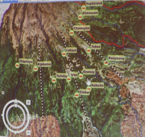
Proposed monitoring plan. Dotted lines represent proposed path for transect
Once the monitors have been identified they will undergo further training on the methods. This will be followed by a pilot phase during which the monitors will gather data on a monthly basis. Once they have demonstrated proficiency in data collection, full rollout will commence, with data collection occurring once every three months.
The principles held by the Ogiek community steer the monitoring process, potentially contributing significantly to the advancement of both community land rights and conservation efforts.