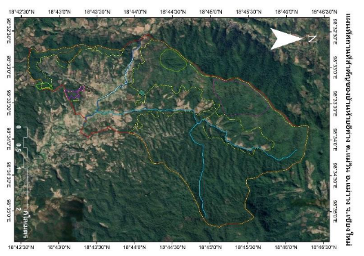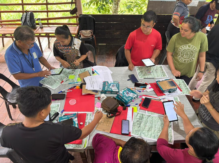
Following the successful Community Mapping and Land Use Workshop held from 18th to 20th February 2025 at the PACOS Training Centre, participating communities have now developed their own land use and conservation zone maps. This marks a key milestone in their journey with the Transformative Pathways project, strengthening their capacity to sustainably manage and protect their customary territories.
The workshop brought together representatives from nine indigenous communities across Tenom, Keningau, and Penampang, who worked collectively to define and map key zones within their ancestral lands. These zones include areas for agriculture, resource use, sacred and protected sites, as well as biodiversity-rich areas such as forests, rivers, and freshwater ecosystems.
As a direct result of the participatory mapping process, each community now has a visual and documented layout of their territory, clearly identifying:
- Agricultural lands and resource gathering areas
- Sacred and cultural heritage sites
- Tagal zones (Green, Yellow, Red) for river conservation
- High biodiversity zones important for conservation
- Areas under threat or requiring stronger protection measures
These maps not only reflect the communities’ deep knowledge and connection to their land but also serve as essential tools for advocacy, local planning, and negotiations with government agencies and other stakeholders.
Several communities, including Kampung Rantai and Kampung Bundu in Keningau — have integrated their Tagal river zones into the new maps and are now working towards strengthening community-based monitoring systems. These initiatives are vital in addressing illegal fishing activities and upholding traditional conservation practices.
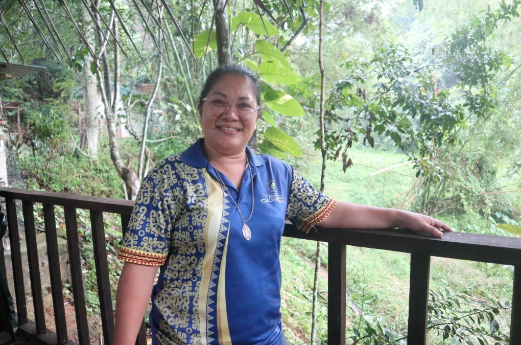
Lydia Alfred, from Kampung Bundu, shared the logistical and participation challenges her community faced (Photo Credit: PACOS Trust)
“One of the biggest challenges during our zone mapping process was the time constraint among all the committee members, as our availability differed. Some were able to participate, while others could not. In the end, full participation ultimately came only from the committee members. Involvement from youth and women was notably unsatisfactory.”
Despite these difficulties, Lydia emphasized the long-term value of the process, particularly in reviving Tagal knowledge among youth, improving land stewardship, and establishing clear boundaries for future generations.
Adding to this, Filistus from Kampung Rantai shared the physical and environmental challenges they encountered during mapping:
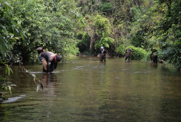
“One of the challenges we faced during the zone mapping process was having to cross deep rivers and navigate through areas with many fallen trees. Collecting GPS data was also difficult and required extreme accuracy to avoid data errors — because this data is crucial for future reference. The landscape of the river constantly changes, and this must be considered.”
He also pointed out the emerging conservation issues in their Tagal area: “Wildlife conservation within our Tagal zone is also difficult. Recently, we experienced a sudden die-off of a fish species called Ikan Pelian. The cause of this is still under investigation.”
Lydia Alfred, from Kampung Bundu, shared the logistical and participation challenges her community faced (Photo Credit: PACOS Trust)
“We faced challenges involving youth, women, and elders many lacked confidences in the purpose and benefits of zone mapping. In the end, it was only us, the committee members, who carried out the mapping process, as we strongly believe that one day, our community will understand and appreciate the value of this zoning map.”
The benefits, however, are already being felt:
“Future generations will no longer have to wonder where our boundaries are especially the Tagal areas. With the map, all boundary information is visible and easy to understand. There will be no more disputes like, ‘This area belongs to me,’ or, ‘This area is off-limits,’ or, ‘This area is okay to use.’ Personally, the presence of this map allows me to protect and conserve the plants and animals that live within and around our care zones’’.
‘’In the long term, I believe this zoning map is very valuable because it can be used as an easy-to-access and easy-to-understand reference. Now, after the mapping has been completed, there’s no longer a need to visit the zone physically as the area can be viewed and monitored using smartphones or modern technology.”
In Kampung Tampasak, the updated maps reflect the community’s traditional territory in the Babagon Dam area, from which they were displaced in the 1980s. With support from the Transformative Pathways program, the community hopes to use these maps in future dialogues with local authorities to gain official recognition of their rights and reclaim access to sustainably use the land and its resources.
- With the mapping work now completed, the next phase of the project will focus on:
- Finalizing and validating the maps with the wider community
- Using the maps to develop community protocols and land use plans
- Strengthening conservation zones and monitoring systems
- Capacity-building for youth in documentation and advocacy
- Engaging local authorities for the recognition of indigenous land rights
The communities have expressed that these maps not only provide a clearer understanding of their territories but also lay a stronger foundation for protecting their natural resources, cultural heritage, and livelihoods for future generations.
As Winnie Joannes from Kampung Tampasak shared:
“The reason the Tagal is important is to conserve the local fish so that the fish will continue to exist in the river. So far, a lot of these local fish have faced extinction, mainly because the fish were washed away or the villagers have overexploited the fish.”
Through collective effort, knowledge-sharing, and the continued practice of traditional wisdom, these communities are shaping a more sustainable, resilient, and self-determined future. Their voices, their youth, and their land, all protected by the maps they now hold in their hands are guiding the way forward.